OREGON 2015 FLIGHT
It had been a few years since I made it back to Oregon, so now was the time to make the trip again. I planned to visit a fellow Pulsar pilot in Big Bear, CA, take pictures of Mono Lake, stop in at a couple more coastal airports, float the Deschutes River in Bend and, of course, eat as many wild blackberries as possible!
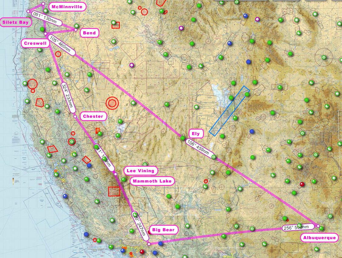
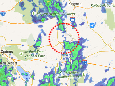
The flight to Big Bear across NM, AZ & SoCA would normally be hot and turbulent as the day progressed. However, I had the luxury of overcast skies, making for a reasonably cool and calm first leg. Of course, with weather comes, well, weather! Here was my path through the biggest chunk.
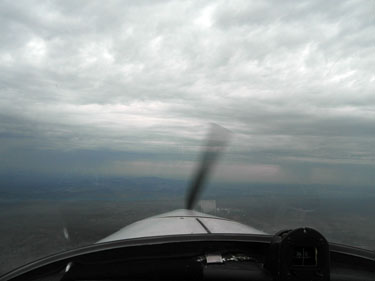
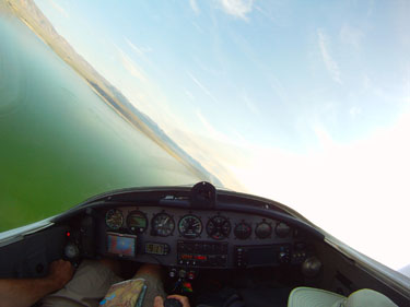
Here's how the weather from my screen capture (left) looked from the cockpit. A brighter section between the darker weather areas always helps to choose a path! I only had a light dusting of rain squeezing between the storms. I kept an eye out for lightning and felt comfortable having no bad indications.
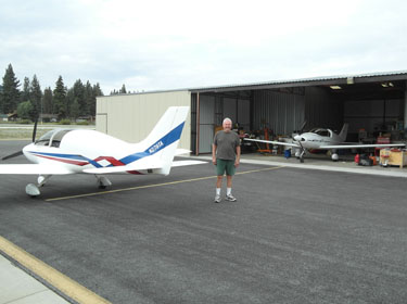
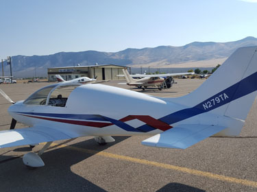
On the ground at Big Bear for an overnight visit. Bob is standing next to my Pulsar outside of his hangar and Pulsar. It was a fun visit with a nice tour of Big Bear and plenty of airplane/engineering talk!
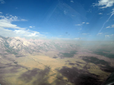
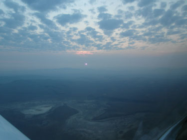
Takeoff the next morning and the flight through Owen's Valley. Smoke from the wildfires began to get thick through this area as can be seen in the distance.
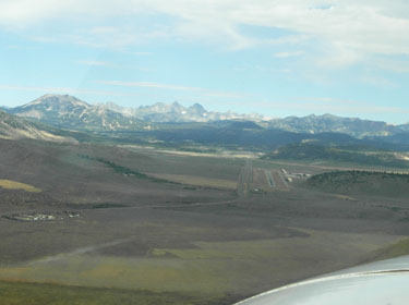
On the way to Lee Vining airport, I remembered there was no fuel available at Lee Vining. I opted to stop along the way at Mammoth Lakes for a quick fill up. The runway is visible in the distance.
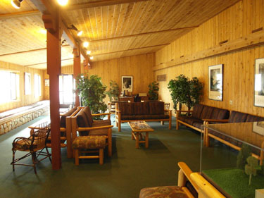
Mammoth Lakes FBO was beautiful! The interior was all natural wood and there was a quaint cafe counter inside.
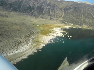
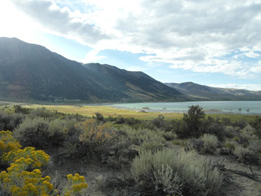
Back into the air toward Lee Vining, I took a lap around Mono Lake to check out the lay of the land and where I wanted to set up for pictures. Ah, the benefits of aerial surveillance!
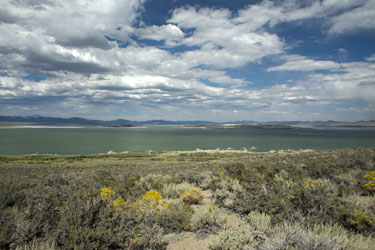
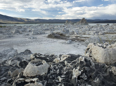
The lake is interesting for its geological formations. It is fed by one stream but has no outlet. The stream is fresh running water, but the lake itself is brinish. I had seen interesting pictures of it and wanted to give some photography a try myself during this trip.
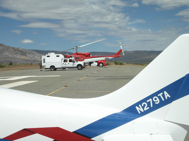
I shared the ramp with a firefighting outfit. I visited with the onscene director and he told me they were just waiting for their next assignment. They had just finished extinguishing a fire outside of Yosemite and he said the week prior, the entire airfield, to include the runway itself was crowded with firefighting equipment and helicopters.
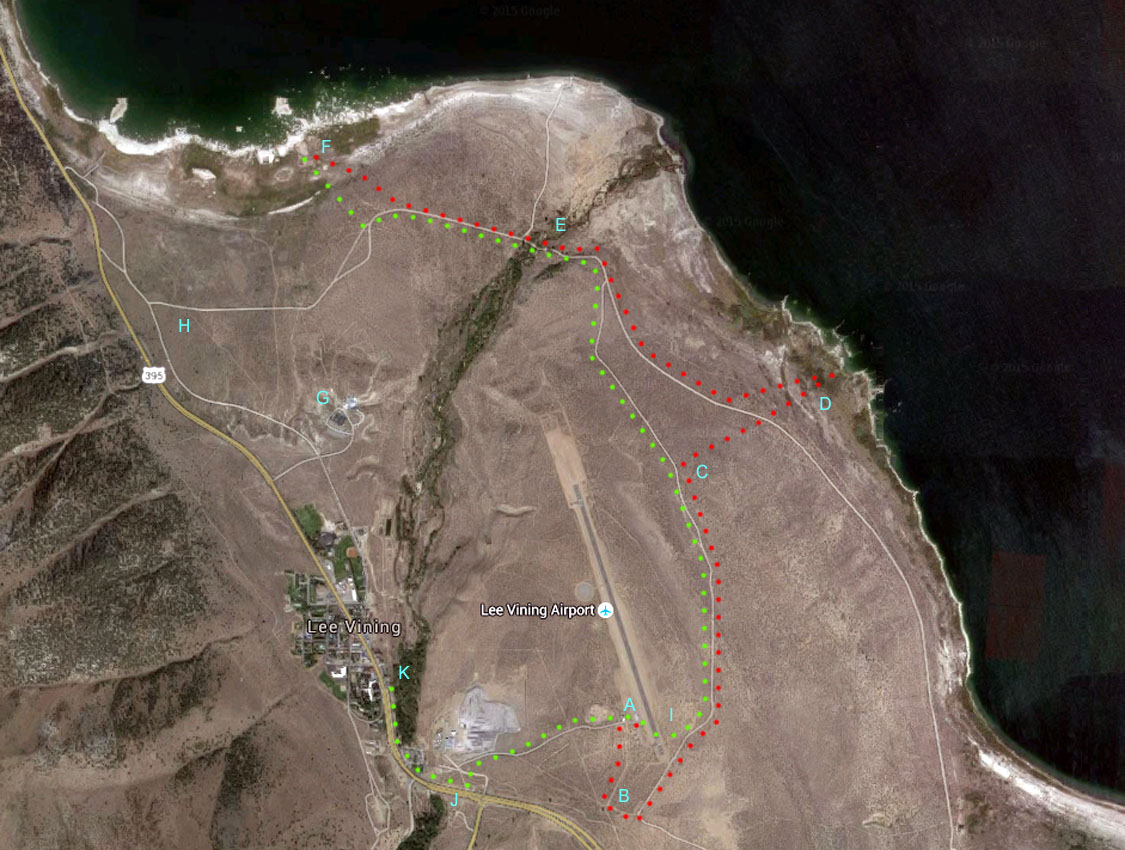
I parked my plane at "A", grabbed my camera backpack and proceeded along the red path. I only had about 1.5L of water, which I already knew was going to be an issue. I thought I had more, but that was it and I didn't want to risk the time required to go into town for more. I walked out the airport gate along a dirt road around the perimeter fence at "B". I wasn't sure of the path if I attempted a shortcut at "I" like I did on the return. I wanted to go to the closest area of interest, which was "D", so I opted to go through the thicket starting at "C". It was rough, but doable with plenty of scratches on my legs. When I got to "D", the brush was extremely thick and by the time I got to the craggy rock formations, it was clear I would never make it to the water or even get close. Not to mention, it would be very ugly to get back through the thick brush in the black of night!
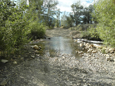
I opted for a "Plan B", thinking I should be able to get to the more visited area at "F" prior to sunset with a good hour's worth of hiking. I plowed through the brush and rejoined the dirt road, making the trek easier. At "E", the stream that feeds Mono Lake floods the road and there's no way across without wading calf-deep. I took off my boots and socks and rediscovered what bare feet felt like again!
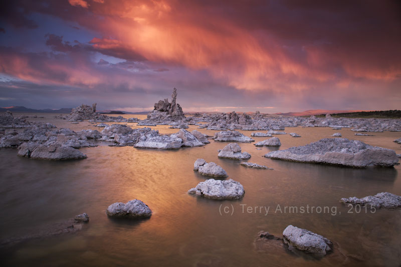
Upon nearing my new destination at "F", the road veered away, requiring more stomping through the brush. Fortunately, about half the off-trail distance was high grass, compared to most everything else which was hard, thorny scrub brush! When I got close to the water, the ground was mushy as expected. I found a reasonable place to take my photos and I kept snapping through sunset. As soon as sunset was over, I packed up and started back to the plane. Since it was getting dark fast, I knew this was going to be the real adventure!
On almost every hike, I have a minimum of survival gear. Since this was a "photo excursion", I had a pack with camera gear and not too much else. I had a good flashlight, but the batteries were already fading with no spares; rather ill-equipped for my normally over-equipped self! The entire area was deserted. As I assessed my options, I really wanted to go directly up to the park visitor location at "G". However, that trail looked tenuous for a night hike compared to the dirt road. Plus, it required going up an escarpment with an ill-defined trail. I thought seriously about hiking toward "H" and getting to the main highway. However, that was going a long ways out of the way since I still had to get to my plane for my overnight bag. I opted to return the way I came since I knew what to expect and it was the shortest route. It was going to be dark with not another soul around!
I started back through the brush from "F", working my way through waist-high grasses, tree thickets and who knows how many critters! I found the dirt road and began walking the return path. I stopped and almost turned toward the opposite highway route once I saw the desolate direction I was about to walk in the dark. There was something comforting seeing the lighted cars in the distance with the highway option, but it was just too far. I pressed forward into the night and again removed my boots and socks for the stream crossing. With all the trees and water at the stream, I figured if I was going to be eaten by a bear, this would be the place! At least I'd be running barefoot through the dark of night in the middle of nowhere, screaming for no one to hear!
I made it through the creek with only a few bear rustlings somewhere in the darkness and started to cover the distance back to my plane. The flashlight was all but dead by now, so I turned it off and managed to enjoy a bit of moonlight starting to peak occasionally through the clouds. This was "machine-mode" hiking now to just kick out a strong pace on the steady uphill grade. The primitive road was often soft and sandy, but sure, as I made my way to "I" where I discovered on the way out that the road abutted the perimeter fence. I hopped the barbed wire fence, walked across the runway and up to my plane. I wouldn't try that at DFW, but on an otherwise uncontrolled and unattended airfield... well, I felt I had a really good bear story ready, if need be!
After exchanging my camera pack for my overnight bag, I began to hoof along the hard surface road into town which took about another half-hour. The shower and room never felt so good!
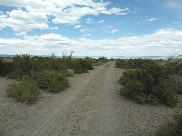
The dirt road was relatively nice to hike. The hard scrub brush off the road... not so much.
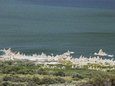
My original destination at "D" in the distance. This is where I hopped off trail at "C", making my way through the scrub in shorts and hiking boots.
Taken with my telephoto lens, it definitely looked like an interesting area. The (lack of) path looked challenging, but plausible from here.
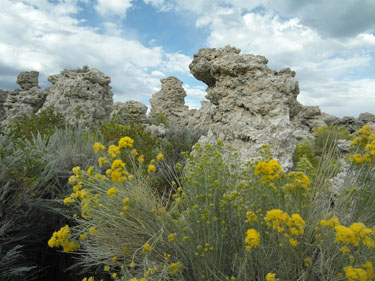
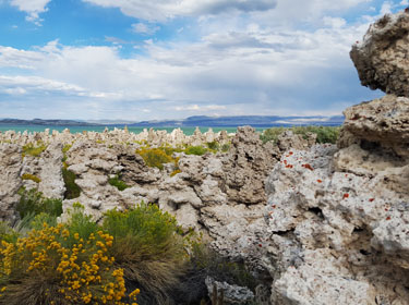
I climbed up these first rock features to look at the shoreline in the distance. The extremely difficult terrain and distance required made it clear this was the end of the line. I couldn't do it in daylight and darkness would be the essence of nightmares! I struggled back through the thicket and on toward alternate point "F".
The stream crossing at "E". There were "almost" enough rocks/logs in place to temp a dry crossing, but closer inspection, I was certain to complete the rest of the adventure with wet boots and wet clothes had I attempted.

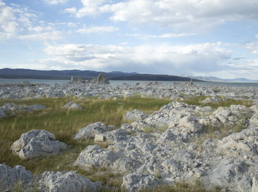
My destination "F" is in sight. This is where I went off trail again.
Getting to the shoreline was much easier after getting through the thicket nearer the dirt road. Relocating to the area proved to be a much better decision than dealing with the first location.
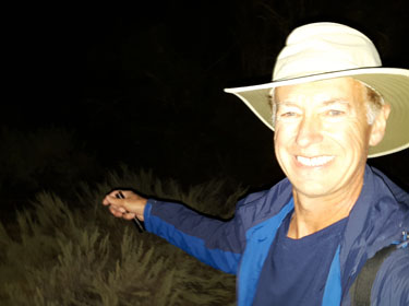
After sunset, I had to thrash my way back to the dirt road in the dark, uncertain as to the exact path, other than upwards to the south! Why am I smiling? I'm not a bear snack yet?
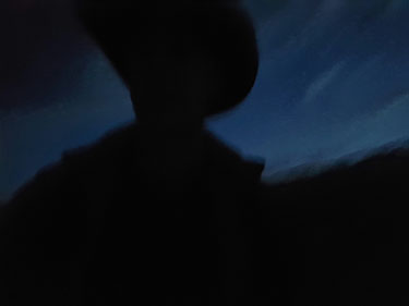
The long, dark hike back to the plane! From the plane, another half-hour hike to the room and a well-deserved shower!
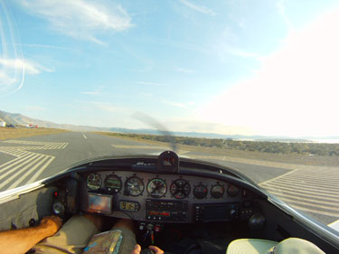
Rolling onto the runway at Lee Vining next morning for takeoff.
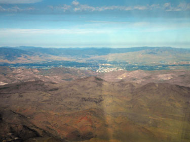
Passing east of Reno, CA. I had planned to check out some of the northern CA and OR coastal airports, and if I did, I would've cruised west around Tahoe. I was tired enough and opted to get to my place in Oregon.
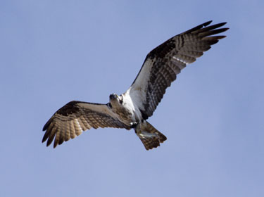
A stop in Chester, CA, for fuel. Lots of Osprey flying around the lake. This one has a fish in its talons.
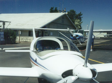

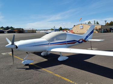
Down at the familiar Creswell, OR, airport, just minutes from my mom's place. Overnight tiedowns are only $2/night.
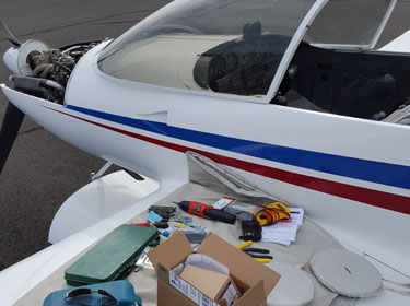
I had actually done a top-end engine overhaul before this trip, to include leaning the mixture and switching to hotter plugs. As a result, my engine was running hotter and I swapped out the old analog gage for a digital one I had sent to my mom's. A simple gage change proved to be anything but simple as I chased correct temperatures, wiring and different senders!
The wild blackberries are prolific around this time of year in Oregon. It's a requirement to eat a year or two's fill!
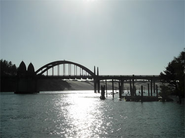

An afternoon drive to the coastal town of Florence for a bowl of Mo's clam chowder; the best ever! I've flown into Florence before, but the airport is not convenient enough to get around without a vehicle.
A very pleasant evening outside at a restaurant in Eugene with mom and sis.
Kim joins in for the Labor Day weekend and more eating!
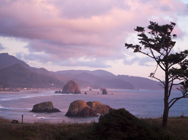
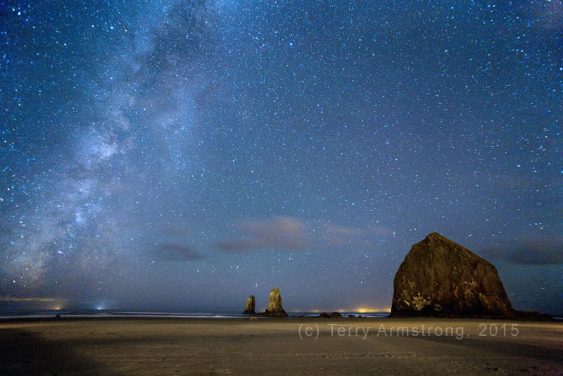
I planned to fly to Cannon Beach to meet up with my F-15 friend and his family, but the enroute weather was too cloudy and rainy. We drove instead.
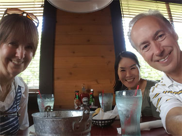
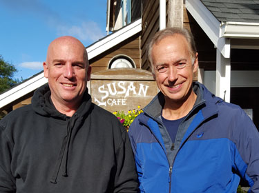
Outside the restaurant that Scott normally never gets to eat since it's usually the ladies-only get together place. We discovered the secret they were keeping was the incredible bacon! Bacon! It's the best I've ever eaten!
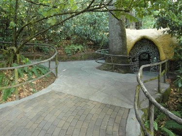
On the way back home, I decided to stop at the Enchanted Forest. I've seen this place over the years as a kid and never got to stop. A few years ago, I actually read a story of the guy who started this place as his dream. I finally got to visit it! It's quaint and looks to be a lot of fun for youngsters!
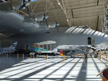
Another excursion was to check out the Spruce Goose in McMinnville, OR. A fellow Pulsar pilot recommended this as a good stop while in Oregon. I had known Howard Hugh's iconic aircraft ended up in Oregon, but would not have thought about flying here without the recommendation.
The FBO called me a shuttle, and in no time I was at the museum. I'll have to say, the museum rivals the Smithsonian in quality and even to an extent, variety of aircraft. It was surprisingly good. Afterwards, I just walked out from the museum, crossed the 4 lane highway and walked back to my plane at the FBO.
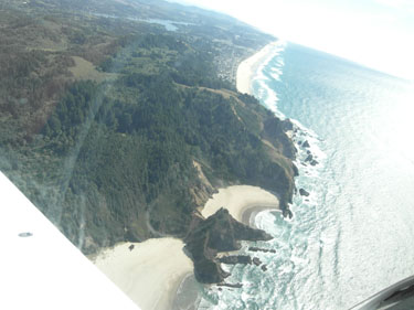
From McMinnville, I planned to fly along the coast and touchdown at Gleneden Beach. I flew up the Siletz River and discovered this completely secluded beach cove that I'll have to investigate on the ground some day!
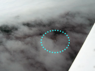
I was going to land at Siletz Bay airport and walk to the beach before returning to Creswell. However, for an otherwise clear day, there were low coastal clouds right were I intended to land! You can just barely see the Rwy 17 numbers through the low level scud. I kept flying.
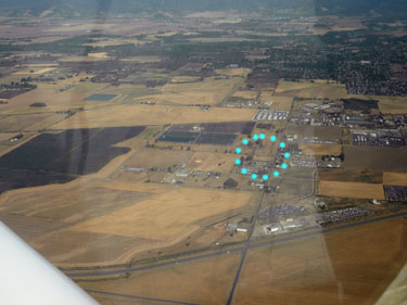
I flew right over the Eugene airport and checked in with Cascade approach. I saw Fern Ridge Reservoir were we swam as kids. I snapped a picture of our little "shop" on 5 acres which is my Oregon home away from home.
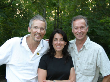
I also drove up to Portland to visit two of my good high school friends. I confess, this picture is from nearly 10 years earlier since I forgot to take a new one! It was a quick lunch visit this time. Oh well, the picture would look that same since Lisa never changes, and us guys just go from salt&pepper to completely gray!
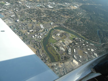
I made an excursion to Bend, OR, with the hopes to float the Descuttes River that runs through downtown. I've seen it via online webcams and it just looks fantastic! I couldn't jump into the water on this trip, but it's definitely inviting from the air...
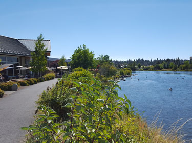
...and on the ground! Bend is a very pleasant town and not as subject to the cloudy conditions on the other side of the Cascades in the Willamette Valley.
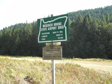
After flying back from Bend, the next excursion was by car to Proxy Falls. Proxy Falls is actually on the way to Bend and passes by the McKenzie Bridge airport. This has always been one of my "desperate divert" airfields over the Cascades, so I decided to stop by for an actual look. It's a grass strip tucked in amongst the tall trees. I now consider it my "very desperate divert" airfield! The nearby highway looked more appealing, minus the cars, of course!

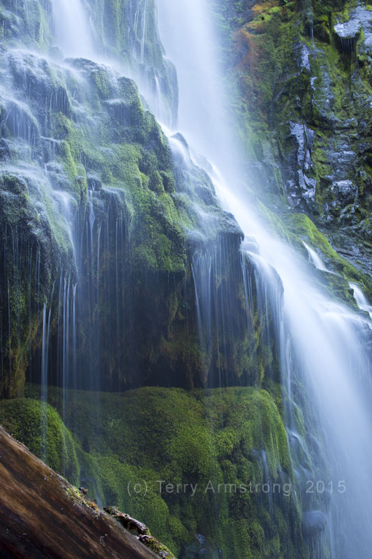
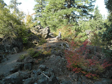
The hike to Proxy Falls was less than a mile on what is described as a family friendly trail. My mom had never before hiked on a trail, so I was a bit surprised when she was interested in the adventure. It was a very pleasant hike and my mom enjoyed it! She does a lot of walking at work, so she was very much up for the task.
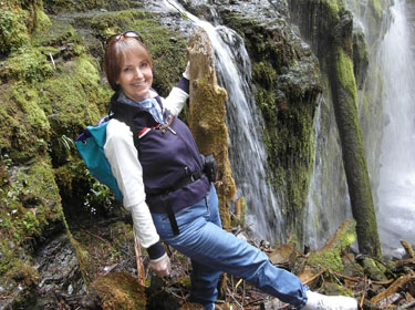
We were able to get right next to the falls after hiking up the stream bed a little. It was incredible and well worth the trip! My mom enjoying the sights!
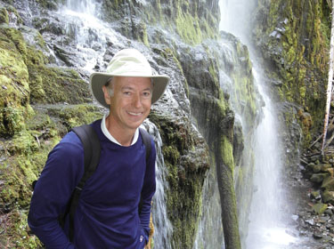
Me right next to the water.
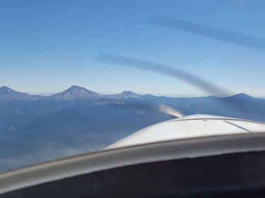

Now it was time to fly back home to Albuquerque. I decided to make best time by flying the two 4.5 hour legs with a stop in Ely, NV, for fuel. However, I dreaded the hot, turbulent air across the deserts. As a result, I decided to get airborne at 0430 and get as much of the trip out of the way before the afternoon heating. This picture is from my daytime flight into Bend across the Cascades with the Three Sisters and Mt. Bachelor rising to 10.5K. This is not how the night flight looked!
This is how the night flight looked at 0430, crossing the Cascades! No, it was actually worse, because this is only a small black square! I was thoroughly immersed in a sight-sucking darkness, devoid of moonlight or ground city lights. It was in the middle of nowhere, at night... again. (I sense a theme on this trip.) I climbed all the way up to 12.5K' and made one 360 degree turn to gain more altitude before committing across the mountains. At 12.5K, I knew I had clearance for any pesky peaks! Wings-level orientation is much easier with instruments, the moon and/or city lights. My attitude indicator is "adequate enough", but I don't consider it a truly reliable IFR instrument, so I kept cross-checking it against the stars. Fortunately, both Orion and Jupiter were rising in the east.
Needless to say, I celebrated the dawn! I was still over the middle of nowhere, but at least it was light and the mountains were behind me, for now.
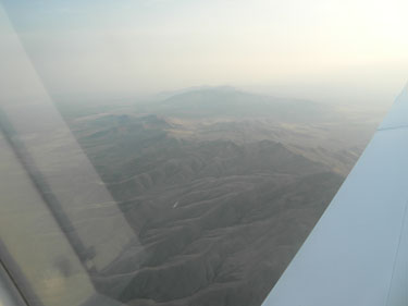

Basically, 8 out of 9 hours is over the desert. If I were a travel guide writing about treasures of the Southwest, I'd rat this place out and recommend Hell instead! (Mild apologies to Nevadans, Christianity and almost a bit of Riddick.)
Ely, NV. Again. This is a place surrounded by high mountains that require circumnavigating at 11.5K'. Dropping into or departing from this airport would not be a dark night VFR task!
More desert. Are we there yet? I made it safely back to Albuquerque and beat most of the daytime heating. Only during the last 30 minutes in NM did the turbulent air rattle my plane around. All-in-all, another great trip in the Pulsar!